Large-Scale Crop Classification from Satellite Images
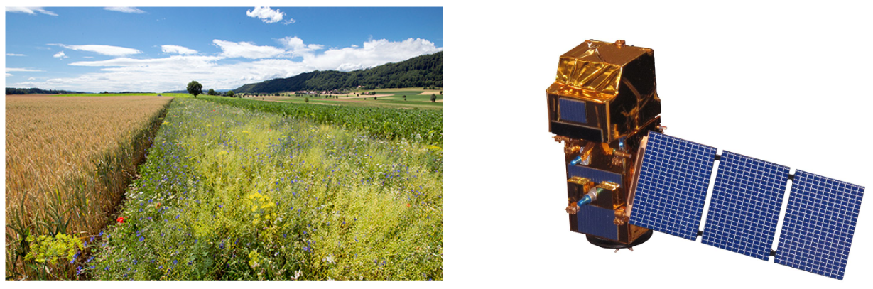
The monitoring of agricultural areas is of high importance for food production, biodiversity, and forestry. Increasing world population and changes in food consumption habits require new agricultural areas or intensification of existing agricultural areas. Cropland expansion and intensive use of agricultural areas are often connected with negative ecological impacts like deforestation and biodiversity loss. Therefore, crop monitoring is essential for proper, optimized and improved management of agricultural areas. Crop monitoring tasks like validating cultivated crop types, detecting over-fertilization, and estimating the grass cutting frequency is a time-consuming, laborious and costly process today. Moreover, sending human inspectors on the ground leads to very sparse data in both time and spatial extent. It is thus important to develop automated systems that monitor crops based on remotely sensed imagery densely in space and time. Therefore, the Swiss Federal Office for Agriculture (BLW) has initiated a four-year project in 2018 to develop an automatic system for farmland inspection from satellite images. Within the scope of this project, we are currently working on crop type classification method from publicly available Sentinel-2 images.
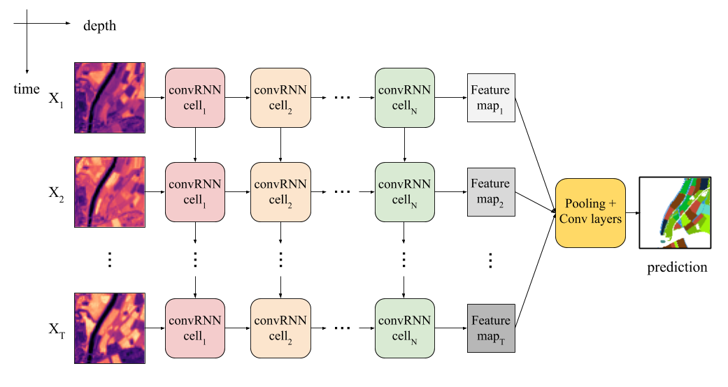
Most previous work uses physics-inspired models. They compute one or multiple vegetation-related indexes, form time series, and feed them to a classifier, e.g, a random forest. Such models capture only a limited part of the complex reflectance distribution of the vegetation and its evolution. We posit that this is one of the factors that limit their performance, and undermines their robustness against noise in the data, even when advanced pre-processing techniques are used. Our approach is based on deep learning, which has recently shown great success in prediction tasks, from both image data and time series (e.g. in speech processing). We use a recurrent multi-layer neural network to learn the complex spectral, spatial and temporal patterns that differentiate different crop types from raw data. Our model is fed with a temporal sequence of images and encodes both spectral and temporal information, from which it then predicts the likelihoods of different crop types (see Fig. 2). We do not do any pre-processing, rather we let the model learn to disregard uninformative and noisy data, such as clouds and cloud shadows.
Publications:
Turkoglu, Mehmet Ozgur, Stefano D'Aronco, Jan Wegner, Konrad Schindler: external pageGating revisited: Deep multi-layer rnns that can be trained, IEEE Transactions on Pattern Analysis and Machine Intelligence, 2021
external pageCode
external pageBlog
Turkoglu, Mehmet Ozgur, Stefano D'Aronco, Gregor Perich, Frank Liebisch, Constantin Streit, Konrad Schindler, Jan Dirk Wegner: external pageCrop mapping from image time series: deep learning with multi-scale label hierarchies, Remote Sensing of Environment, 2021
external pageCode
external pagePoster
Metzger, Nando, Mehmet Ozgur Turkoglu, Stefano D'Aronco, Jan Dirk Wegner, Konrad Schindler: external pageCrop Classification under Varying Cloud Cover with Neural Ordinary Differential Equations, IEEE Transactions on Geoscience and Remote Sensing, 2021
external pageCode
Project partner:
Swiss Federal Office for Agriculture (BLW)
Contacts:
Jan Dirk Wegner, ETH Zürich,
Mehmet Ozgur Turkoglu, ETH Zürich,
Stefano D'Aronco, ETH Zürich,
Frank Liebisch, ETH Zürich,
Jérôme Frei, BLW,