Research
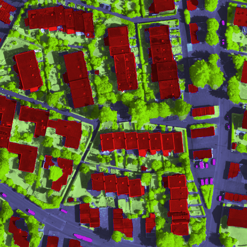
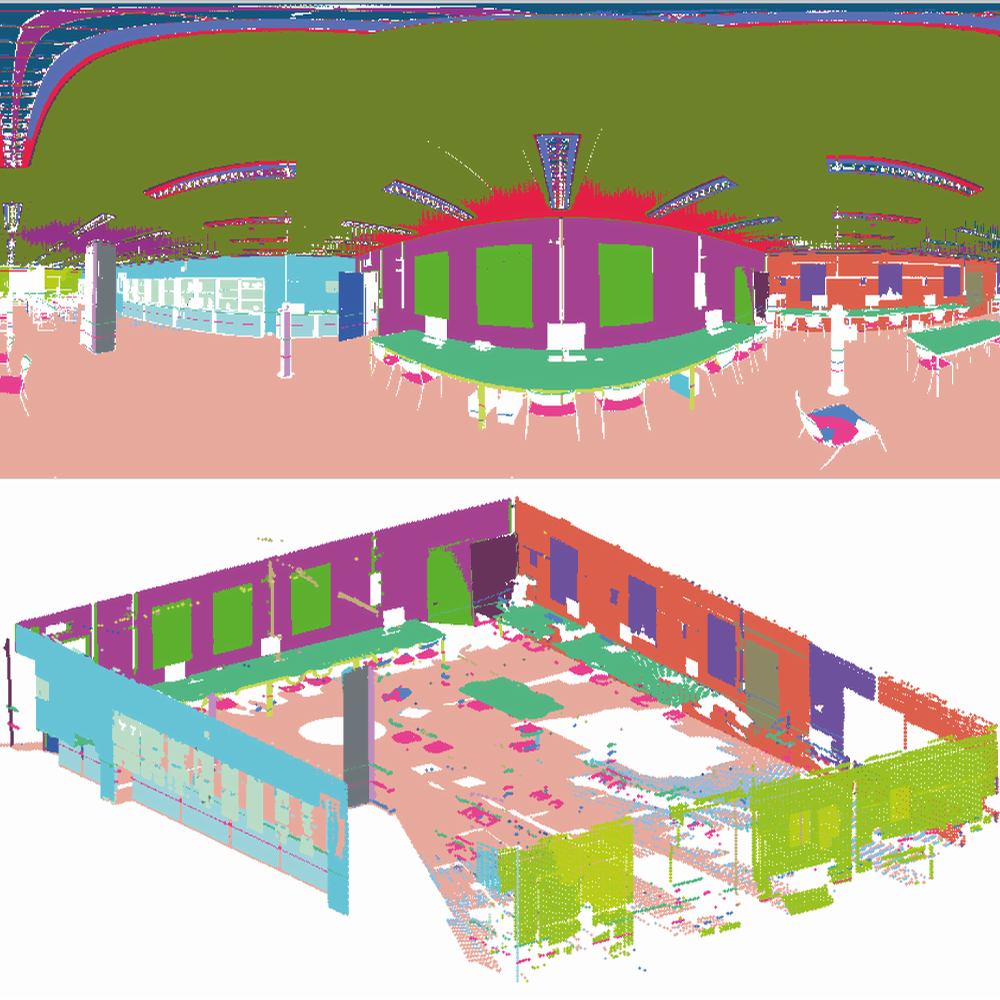
Photogrammetry is the science of converting image-like sensor data into useful geo-information. The image data we are interested in comes from various sources, including consumer cameras, airborne photogrammetric cameras, laser scanners, optical and RADAR systems on remote sensing satellites, etc. The products we usually deliver are large-scale geometric models (such as for example digital 3D models of the earth's surface) and or semantic models (such as for example land-cover maps). Our research focuses on automatic image interpretation, i.e. we aim to create computer systems which can, with minimal user interaction, extract both accurate geometric measurements and useful semantic interpretations of the observed world from the image data.