Combining Deep Learning and Social Media Data for Flood Water Height Estimation
Floods are among the most common and expensive natural disaster and affect millions of people worldwide. During such an event, it is essential to build accurate flood maps for emergency plan operations and rescue. To build such accurate maps it is essential to have data from the disaster area without much delay. But the traditional methods are not able to provide these observations on time. The classical monitoring approaches like stream gauge, remote sensing and field data collection have several limitations. For instance, remote sensing data from satellites though being rather inexpensive does not provide real-time access during a disaster due to the long revisit cycle of satellites. Stream gauges provide near real-time information but their monitored locations are dispersed. The field data collection approach is expensive, labour-intensive and dangerous. This limitation can be overcome by leveraging social media platforms. The data from social media platforms have the advantage of being available in real-time. Developing an effective and automatised way to extract useful information from images collected from social media would save valuable time.
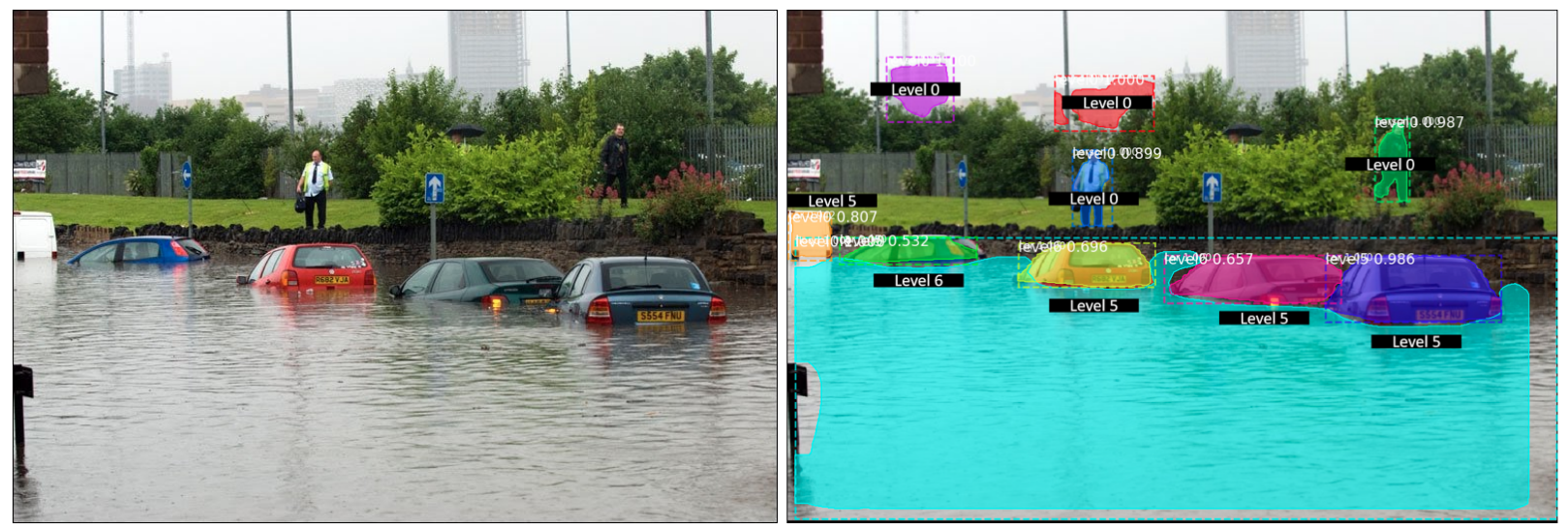
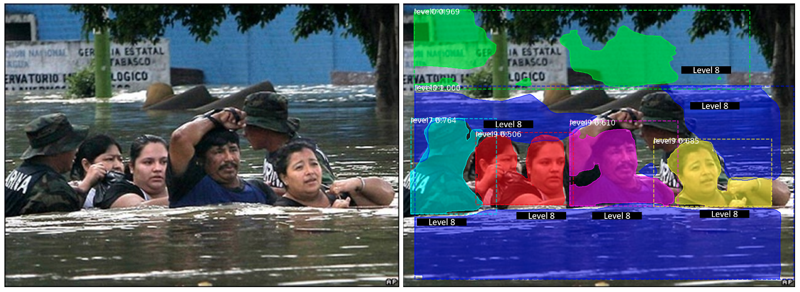
In our initial work, we presented a model to predict flood height from images gathered from social media platforms in a fully automatic way. The main complication stems from the fact that the water level might not be univocal, as it can vary across different zones which are visible in the image. In order to work around this problem, we look separately at the different objects that appear in the picture and we estimate for each of them individually, how much they are submerged in water. The prediction was done using a deep learning framework. The proposed model was built on top of Mask R-CNN architecture and it performed object instance segmentation and predicted flood level whenever an instance of some specific object was detected.
We further try to develop an approach with weak supervision. To do that, we propose a deep learning approach where we define the flood estimation as a per-image regression problem and combine it with a ranking loss to further reduce the labelling load. The motivation is to utilise relative ranking instead of absolute flood levels. The regression task trains for predicting absolute flood levels for images and the ranking task uses the pairwise comparisons between images to learn the ordinal component of the problem. Using these weak annotations from ranking, we want to improve flood-level estimation.
Publication:
Chaudhary, P., D’Aronco, S., Moy de Vitry, M., Leitão, J. P., and Wegner, J. D.: external pageFlood-Water Level Estimation from Social Media Images, ISPRS Ann. Photogramm. Remote Sens. Spatial Inf. Sci., IV-2/W5, 5-12, 2019.
Project partners:
Department Urban Water Management, Eawag - Swiss Federal Institute of Aquatic Science and Technology, Switzerland
Contacts:
Jan Dirk Wegner, ETH Zürich,
Priyanka Chaudhary, ETH Zürich,
Joao Paulo Leitao, EAWAG,