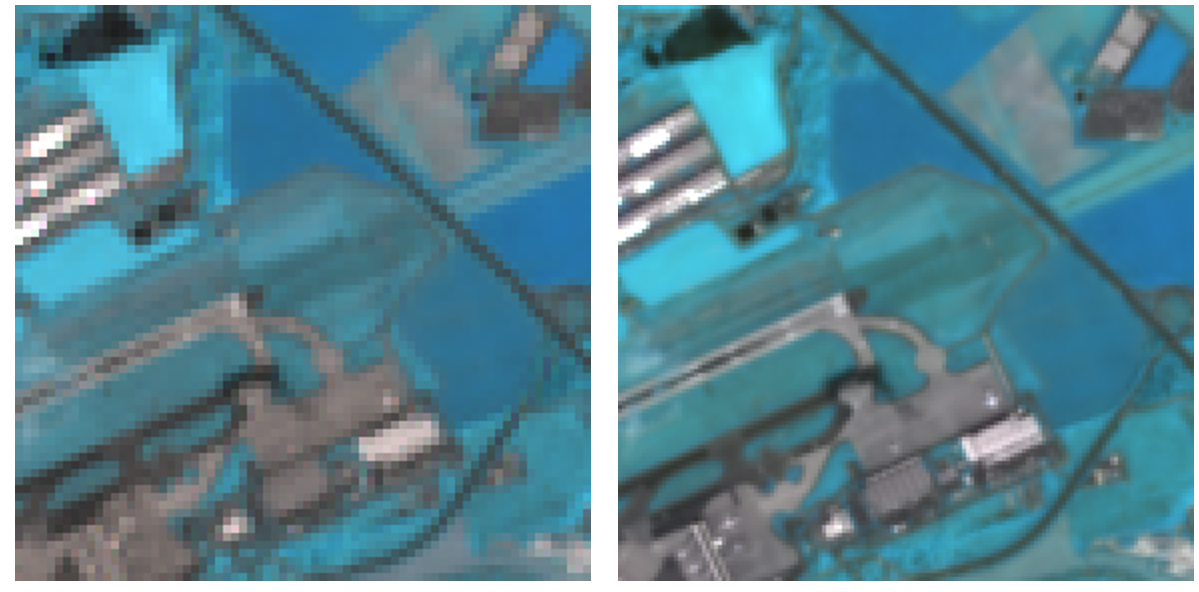
Super-Resolution of Multispectral Multiresolution Sensors
Remote Sensing sensors, such as MODIS, Aster, VIIRS, Worldview-3 and Sentinel-2 acquire multispectral images in variable spatial resolutions. For example, Sentinel-2 acquires spectral channels at 10, 20 and 60 meters. The aim of this project is to increase the spatial resolution of the lower-resolution bands to the highest available resolution of the sensor. This is enabled from the fact that the underlying geometry of the scene is the same. Inferring the maximum spatial resolution in all wavelengths can create new opportunities to better observe clouds/ice/snow and estimate climate variables.
Publication:
Charis Lanaras, Jose Bioucas-Dias, Emmanuel Baltsavias, Konrad Schindler: Super-Resolution of Multispectral Multiresolution Images from a Single Sensor (PDF, 1.4 MB), IEEE CVPR EarthVision Workshop, Honolulu, 2017
Code:
external pageSupReME: Super-Resolution for multispectral Multiresolution Estimation
external pageDSen2 (Deep Sentinel-2): Super-Resolution of Sentinel-2 Images
Contact:
Charis Lanaras, Jose Bioucas-Dias, Dr. Emmanuel Baltsavias