Integrated Lake Ice Monitoring and Generation of Sustainable, Reliable, Long Time-Series
The final project report is available Downloadhere (PDF, 3.8 MB)
Motivation:
Inland water bodies, especially lakes, are of considerable importance in climate change research and global warming studies. Lake ice can indirectly offer hints on alterations in physical and biological ecosystem. The Global Climate Observing System (GCOS) is one of the programmes initiated by the World Meteorological Organization with a vision to provide all users access to climate observations, data records and information. Lake Ice Cover is part of the GCOS Essential Climate Variable (ECV): Lakes. Monitoring and analysing the (decreasing) trends in lake freezing provides important information for climate research. In addition, surveillance of the lake ice fosters development of winter tourism (e.g., for snow polo world cup on frozen St. Moritz lake). Traditionally, on-shore observers used to collect the information on frozen lakes, recording the visible ice-edge. Over the past few decades, the number of field stations declined, due to lack of budget and/or human resources. Day by day, the need for automated monitoring of lakes is gaining significance. There exist already observations and data from regional authorities, publications etc., however they are not systematic and come from different, uncoordinated and not secure sources. Hence, MeteoSwiss initiated the Lake Ice Project (LIP) for an integrated multi-temporal monitoring of lake ice, using not only satellite images, but also exploring the possibilities of webcams and in-situ measurements. This project is a continuation of LIP.
Aims:
Our primary goal is to develop a future-oriented sustainable system for lake ice monitoring, using mainly satellites and webcams, which together form a stable data source. Additionally, this project aims to improve the methods developed in LIP, especially regarding the most promising observations from satellite and webcam images, consolidate them and reduce the time-consuming training, add new sensors, integrate the results, and process a longer series of data. Of particular importance, is the usage of Sentinel-1 microwave data to reduce the grave problem of clouds in Switzerland and also errors in cloud masks for the optical sensors.
Input data:
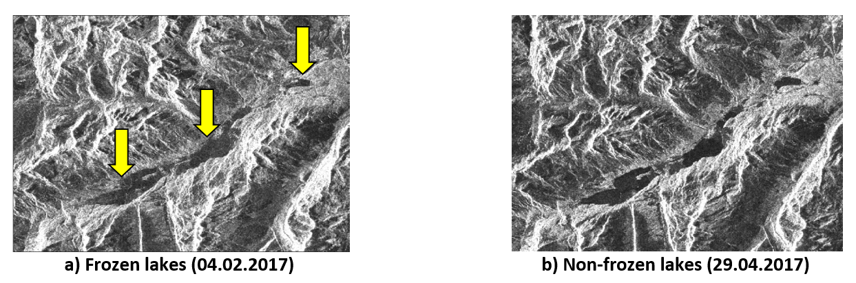
• Low-spatial-resolution Satellite images: MODIS, VIIRS
• Medium-spatial-resolution Sentinel-1 SAR and Sentinel 2 imagery
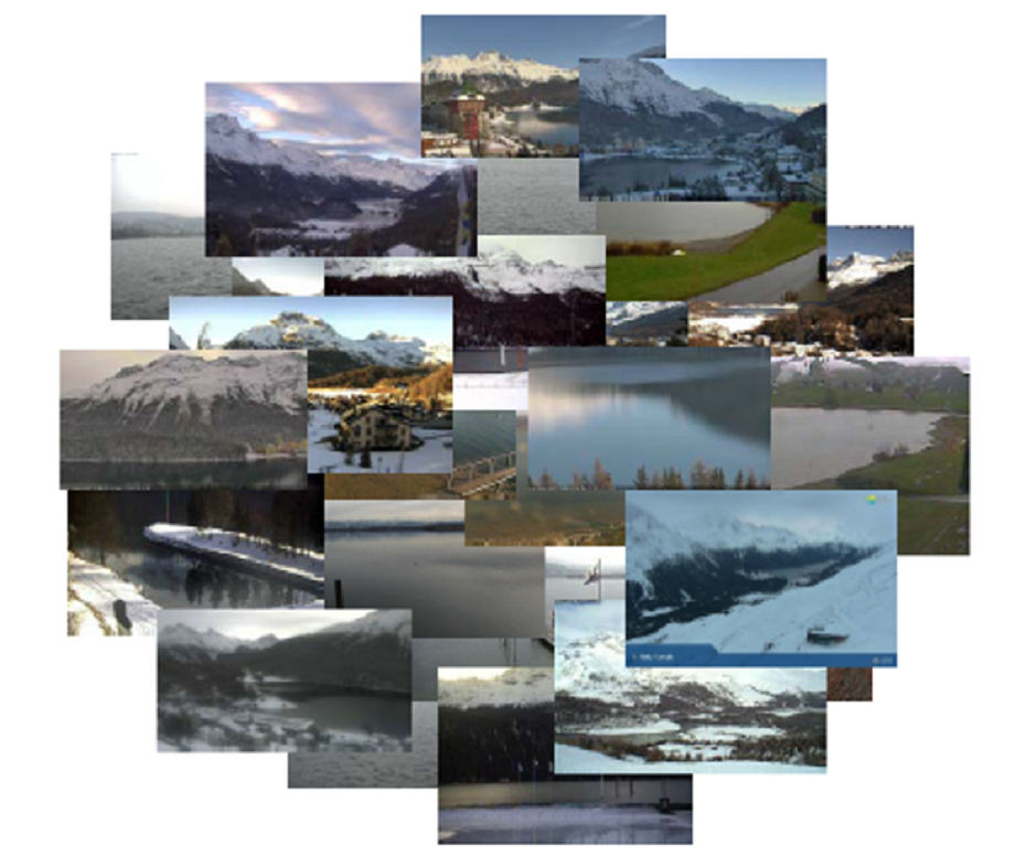
• Public webcams and new better quality PTZ cameras
• Auxiliary meteo-station data
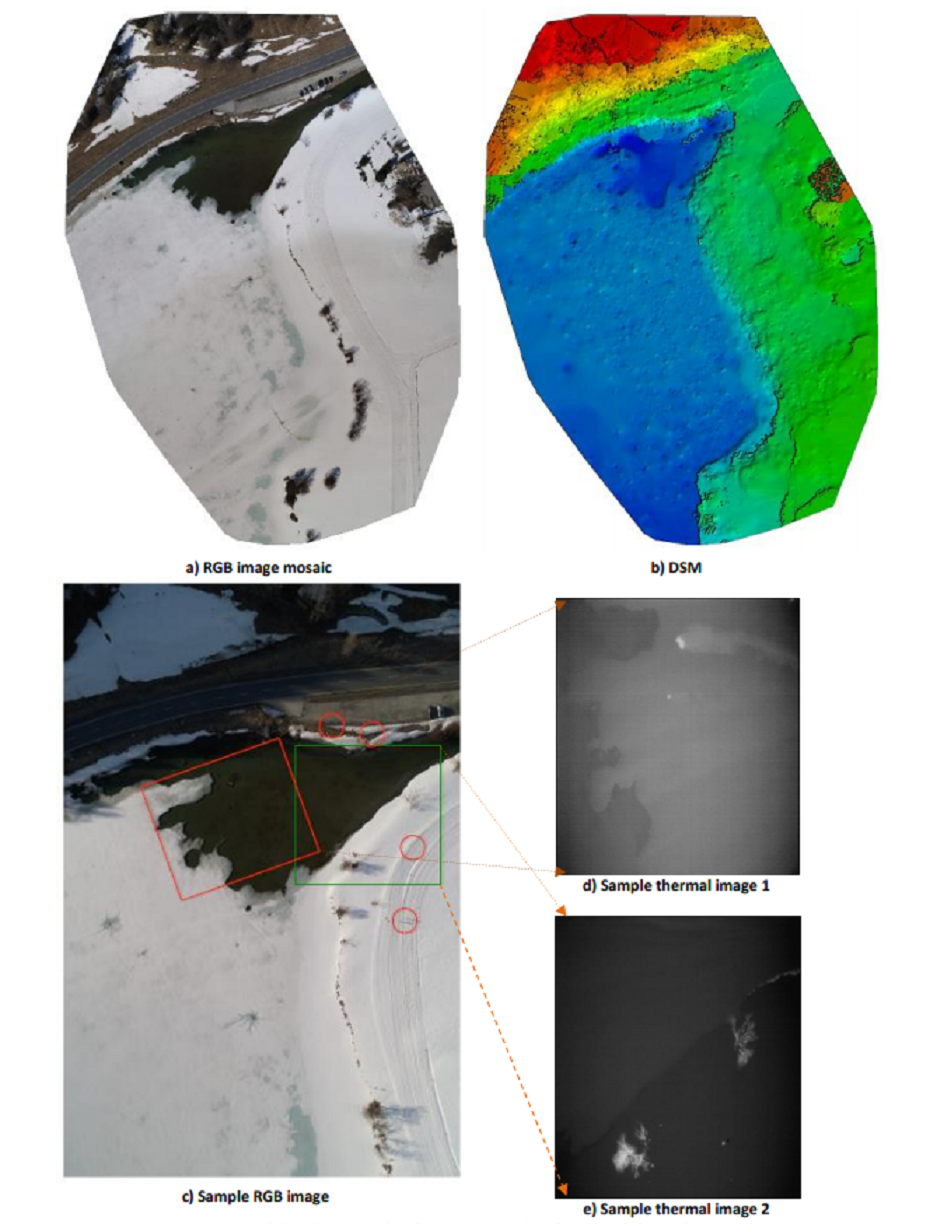
• UAV images (RGB and thermal)
• Crowd-sourced images from social media platforms
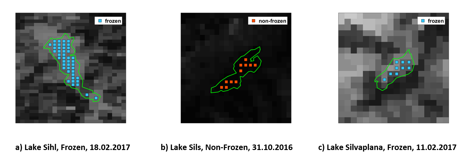
Target lakes:
We analyse four selected lakes in Switzerland (Sihl, Sils, Silvaplana, and St. Moritz) situated in an Alpine environment. They are known to reliably freeze over completely every year during the winter months.
Financed by:
Swiss Federal Government by MeteoSwiss (GCOS Switzerland)
Duration:
Winter 2018 – Autumn 2020
Contacts:
Manu Tom,
Dr. Emmanuel Baltsavias,
Publications:
Tom, M.; Wu, T.; Baltsavias, E.; Schindler, K.: external pageRecent Ice Trends in Swiss Mountain Lakes: 20-year Analysis of MODIS Imagery, arXiv preprint: arXiv:2103.12434, 2021
Tom, M.; Prabha, R.; Wu, T.; Baltsavias, E.; Leal-Taixé, L.; Schindler, K.: external pageIce Monitoring in Swiss Lakes from Optical Satellites and Webcams Using Machine Learning, Remote Sensing 2020, 12, 3555
Tom M., Aguilar R., Imhof P., Leinss S., Baltsavias E., Schindler K.: external pageLake Ice Detection from Sentinel-1 SAR with Deep Learning, ISPRS Congress, Nice, France, 2020 (accepted for publication)
Prabha R., Tom M., Rothermel M., Baltsavias E., Leal-Taixe L., Schindler K.: external pageLake Ice Monitoring with Webcams and Crowd-Sourced Images, ISPRS Congress, Nice, France, 2020 (accepted for publication)
Online articles:
Medium post: external page"Lake Ice Monitoring from Space using Machine (Deep) Learning"
Source Code and Datasets:
- Sentinel-1 SAR analysis (external pagecode, pre-trained model)
- Webcam analysis (external pageCode, external pagePhoti-LakeIce dataset)