Cataloging Public Objects at City-Scale from Aerial and Street-level Images
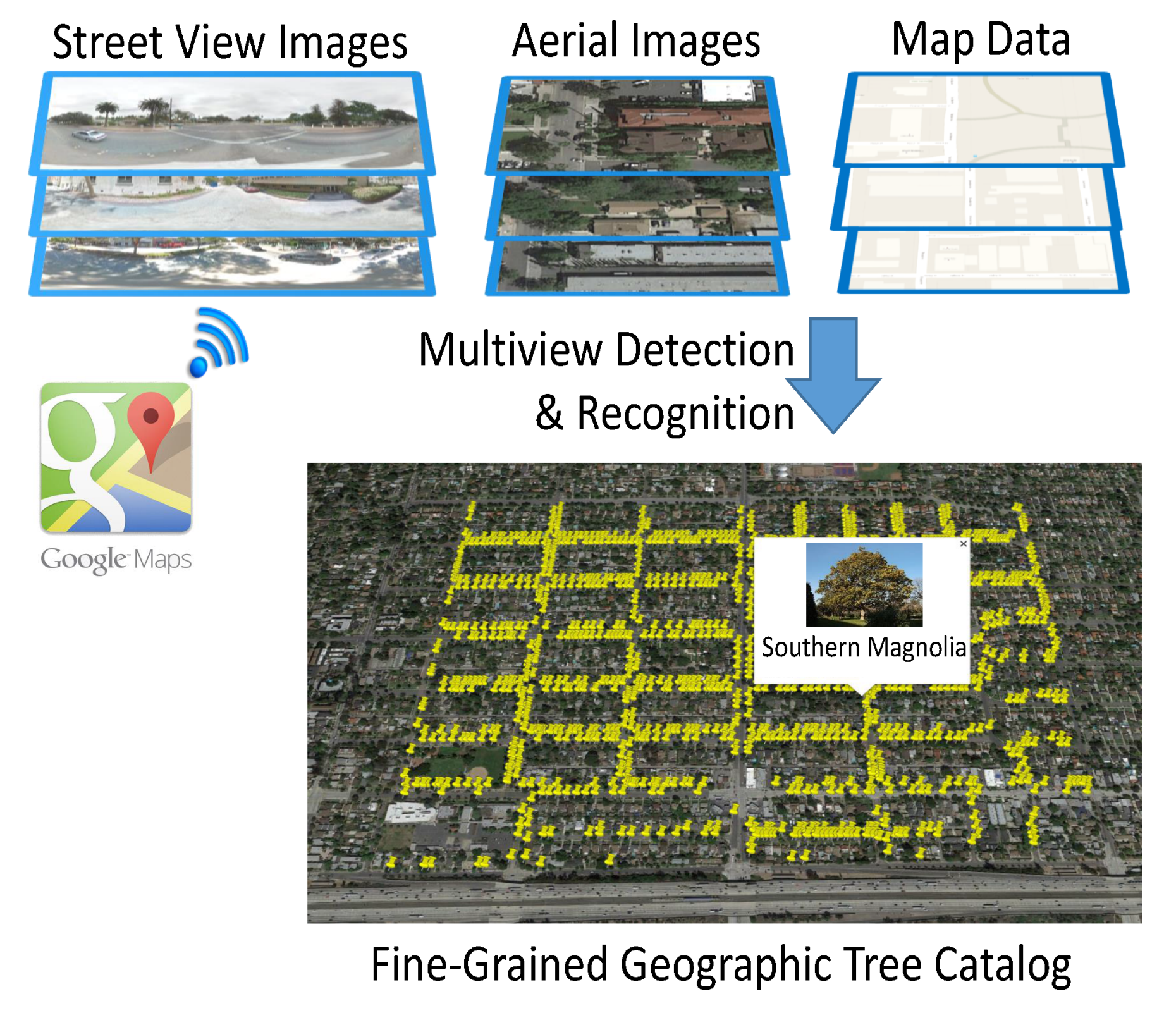
We are developing an automated system that can detect and inventory street trees automatically. From publicly available imagery (Google maps and Google Street View at the moment) of a city, our system produces a list of the location, species and trunk diameter of each street tree. Our approach uses deep learning to identify the location of a tree, classify its species, and approximate its trunk diameter. It combines publicly available geo-referenced Google Maps aerial and street view images along with map data to provide a comprehensive and accurate catalog of street trees. Our algorithm can be used to build an inventory that allows cities to better manage street trees. Cities may detect areas where trees are getting old and need replanting, create an inventory of empty locations where trees may be planted, or detect streets where trees need pruning.
More information: https://www.registree.ethz.ch/index.html
Representative Publications:
Wegner*, J.D., Branson*, S., Hall, D., Schindler, K., Perona, P.: Cataloging Public Objects Using Aerial and Street-Level Images – Urban Trees, IEEE Conference on Computer Vision and Pattern Recognition (CVPR), 2016. (* authors contributed equally to this publication)
Contact person: Jan Dirk Wegner and Steve Branson (Caltech)